On the 21st of September, they found a better port, which Mendana named La Graciosa, for it was very beautiful, larger and more commodious than the one where they were first anchored. A river of moderate size and a copious stream of very clear water gushing from beneath some rocks was found in proximity to the anchorage. Here an attempt at colonisation was made, but what with the hostility of the natives, sickness, and a mutinous spirit, the young colony did not progress favorably. To make matters worse, Mendana himself fell ill and died, and the grand scheme which, under favourable circumstances, might have resulted in the foundation of a Spanish Australian Empire, was, perforce, abandoned for the while. The remnant of this disastrous expedition, having repaired to the Philippine Islands, returned to New Spain in the year 1596.
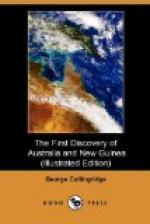
AN EARLY MAP OF THE SOLOMONS ISLANDS.
The discovery of true Solomon Islands was soon forgotten and Mendana’s vague notions about them led historians and geographers astray as to their position and size.*
[* In a map of the South Sea, Mar del Zur, published towards the year 1650, the Solomon Islands are represented as extending in a sweeping curve, resembling their natural trend it is true, but the position is from the locality of New Caledonia and New Zealand, right across the Pacific Ocean to the south of Cape Horn. In that distance 40 islands are represented, of an average size equal to the two large islands of New Zealand, truly a magnificent mistake!]
In the few old maps that exist, it is difficult to determine precisely in what measure the members of the expedition are responsible for the charting; some of it is certainly the guesswork of geographers, based, it must be acknowledged, on the best information then available, for we must bear in mind that the accounts of Mendana’s expedition were only known from a few extracts, the actual narratives being lost at the time these charts were draughted.
Now that some of those narratives have been found, it is easy to identify the present day Solomon Islands with the group discovered by the Spaniards; most of the latitudes in the old chart that I give here, agree with those given by Herrera, the Spanish historian, which shows that if they have been thrown out of position, as they are on some old charts, it is through the fault of the map-makers.
The map given here is by Mazza, an Italian geographer of distinction; it is the earliest one that I have been able to procure, the earliest known to exist, the date being between 1583 and 1589.
I have marked on it the probable track of the ships; the first bay where they anchored, and which was called Baya de la Estrella, is marked by No. 1. The second anchorage, on the coast of Guadalcanal, marked No. 2, was named Puerto de la Cruz; and the locality where the third sojourn was made, and where the brigantine was abandoned, is marked by the No. 3.


