Whatcom county lies on the boundary of British Columbia, stretching from the Straits of Georgia to the peaks of the Cascade mountains—24 miles wide and 100 miles long, The eastern half or more of the county is included in the national forest reserve, with Mount Baker, 10,827 feet high, in the center of the county. It is one of the important counties on tide water, and has an area of 2,226 square miles and a population of about 70,000.
[Page 88] The climate is not different from the general Puget sound climate being mild and healthful. There are no severe storms, no sultry heat and no severe cold.
RESOURCES.
It is estimated that Whatcom county has three billion feet of standing timber. This is its greatest source of wealth. The western half of the county, outside of the lumbering, etc., is blessed with a wealth of soil responding to the farmer’s labor generously.
The eastern half of the county is essentially a mountainous, forest-covered mining region, and has in store many veins of nearly all the metals.
Game of great variety of animals and fowls and fish are abundant.
INDUSTRIES.
The people of Whatcom county are engaged in lumbering and running saw-mills, one of the largest of the state being in this county; manufacturing of various kinds from the raw products in the county, including shingle mills and shingle machinery factory, salmon canneries, planing mills, barrel factories, Portland cement factory, and many others. Of no small importance is farming, fruit-growing and dairying. Prospecting and mining engage the attention and labor of a large number of citizens.
TRANSPORTATION.
Aside from having a long salt-water coast, open to traffic from the ocean, with splendid harbors, the county is traversed in all its agricultural half by a network of railroads, by the Northern Pacific, Great Northern, B. B. and B. C. railroads. These furnish exceptional means of traffic to all industries excepting the mining. The county has also an admirable system of wagon roads, some planked, some graveled and some graded and drained, covering about 700 miles.
[Illustration: Plate No. 83.—Products of Thurston County Waters.]
[Illustration: Plate No. 84.—Thurston County Stick. 14,000 Feet. Sandstone Quarry, Tenino, Thurston County. Logging with Oxen. Early Days in Thurston County.]
[Illustration: Plate No. 84.—Five Combined Harvesters at Work on a Walla Walla County Wheat Farm.]
[Illustration: Plate No. 86.—Ploughing the Ground for Wheat-Growing, Walla Walla County.]
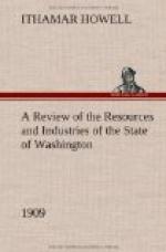
[Illustration: Plate No. 87.—Bird’s-Eye View of a Portion of Bellingham, Whatcom County.]
[Illustration: Plate No. 88.—Typical Farm Scenes in Whatcom County.]
PRINCIPAL CITIES AND TOWNS.


