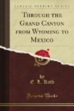
This rapid marks the place where the granite, or igneous rock, intrudes, rising at a sharp angle, sloping upward down the stream, reaching the height of 1300 feet about one mile below. It marks the end of the large deposit of algonkian. The granite, when it attains its highest point, is covered with a 200-foot layer of sedimentary rock called the tonto sandstone. The top of this formation is exposed by a plateau from a quarter of a mile to three miles in width, on either side of the granite gorge; the same walls which were found in Marble Canyon rise above this. The temples which are scattered through the canyon—equal in height, in many cases, to the walls—have their foundation on this plateau. These peaks contain the same stratified rock with a uniform thickness whether in peak or wall, with little displacement and little sign of violent uplift, nearly all this canyon being the work of erosion: 5000 feet from the rim to the river; the edges of six great layers of sedimentary rock laid bare and with a narrow 1300-foot gorge through the igneous rock below—the Grand Canyon of Arizona.
The granite gorge seemed to us to be the one place of all others that we had seen on this trip that would cause one to hesitate a long time before entering, if nothing definite was known of its nature. Another person might have felt the same way of the canyons we had passed, Lodore or Marble Canyon, for instance. A great deal depends on the nerves and digestion, no doubt; and the same person would look at it in a different light at different times, as we found from our own experiences. Our digestions were in excellent condition just at that time, and we were nerved up by the thought that we were going “to the plate for a home run” if possible, yet the granite gorge had a decidedly sinister look. The walls, while not sheer, were nearly so; they might be climbed in many places to the top of the granite; but the tonto sandstone wall nearly always overhangs this, breaks sheer, and seldom affords an outlet to the plateaus above, except where lateral canyons cut through. The rocks are very dark, with dikes of quartz, and with twisting seams of red and black granite, the great body of rock being made up of decomposed micaceous schists and gneiss, a treacherous material to climb. The entrance to this gorge is made on a quiet pool with no shore on either side after once well in.
But several parties had been through since Major Powell made his initial trip, so we did not hesitate, but pushed on with the current. Now we could truly say that we were going home. The Hance Rapid was behind us; Bright Angel Creek was about twelve miles away. Soon we were in the deepest part of the gorge. Great dikes and uplifts of jagged rocks towered above us; and up, up, up, lifted the other walls above that. Bissell Point, on the very top, could plainly be seen from our quiet pool.


